Who: Shirley, Annette and two friends
When: 9-15 Jan, 2013
Five day trip, approx. 4 hours paddling per day.
Deep
in the heart of Te Urewera National Park is Lake Waikaremoana. This treasure is home to one of New Zealand’s
great walks. But we weren’t interested
in tramping it, we were here to paddle it.
This
is one of the most beautiful places in New Zealand, well worth the drive to get
to it. This area boasts the longest
stretch of gravel road in the country. It takes time to drive with a trailer of kayaks and gear. But let me tell you that it is worth every
bump. It is about 5 hours drive from
Auckland. You can approach it from the
other end and avoid the gravel road, or you can stay over in Rotorua on the
down to break up the journey. We stayed at the Mokau Landing DOC campsite.
Tip: We had some free time that afternoon to drive
along to the visitors centre at the corner of State Highway 38 and Aniwaniwa
Road. This was a great idea as we could
ask them for up-to-date weather information and also let them know our
plans. It is important to make sure that
people are aware of where you plan to head in case something goes wrong. Rescue is much quicker if people know where
you are.
Day Two: Bumpy Seas – 2 hours paddling
It took
us longer to pack up the kayaks and get ourselves ready than we expected. We have learned since we did this kayak that
packing takes time. By the time we had
packed we were in need of a cuppa. What better
to use than my brand new kettle!
 |
| Tea tastes better when made in a red kettle. |
Unfortunately our slow progress meant the winds picked
up. We learned from kayakers we met
later on, that early morning and late afternoon are the calmest times on a
lake. If you have a difficult patch to
tackle don’t do it in the middle of the day.
Unaware of this we headed off to cross a narrow part of the lake… in the
middle of the day.
 |
Here we are waiting for the winds to die down
across the
Whanganui Inlet.
|
The winds dropped a bit and we decided to start our
journey. Looking back on that crossing
we learned a couple of important things:
1) If
windy weather is forecast, as I mentioned, don’t cross in the middle of the day
2) Talk
about your plans as a team and make sure everyone understands the plan – before
you launch. Once you are out in the
middle of a bumpy sea it is impossible to communicate! It is important to stick
together and make sure that everyone is doing okay.
With all that said, we made it safely across and found
ourselves a wonderful camping spot. We
named it ‘Best Camp’ but its official name is Otekuri Bay.
Around Lake Waikaremoana we free camped. This means we simply pulled into a bay and
found flat ground to pitch our two tents.
We had been told about a couple of good spots that are used often, and
we found a couple of new spots on the way.
Make sure you take biodegradable toilet paper and a small spade with
you. And in the absence of showers you
will need biodegradable liquid soap to wash in the lake.
This is a national park so putting toxic products into the lake is not a wise idea. I bought a good product from an outdoors shop that worked as a soap,
dishwashing liquid and shampoo.
 |
This is my idea of a perfect breakfast spot!
|
Day two: Umbrellas. A whole day paddling.
A beautiful day awaited us so we packed up camp and headed out
around the headland and through what is known as The Narrows. This is a tricky stretch of water. During certain times of the year this narrow stretch
of water can be very dangerous. We were
cautious, but the day was lovely and our progress was good. Once we exited The Narrows, some good puffs of wind meant we were able to
put Ciao’s sails up and move along at speed. We decided to try out our new toys: umbrellas!
A good sturdy golf umbrella acts like a kayak sail.
 |
| Mary Poppins |
This was the first trip where we tried out umbrellas as kayak
sails. Kirstie achieved great success!
She may not look like she is moving, but she is.
However, we soon learned a good lesson with our
umbrellas. When holding an umbrella it
is important to have this firmly attached to your kayak or life jacket by a strap. If not, a very strong gust of wind will come
along and launch the umbrella into the air and send it into the lake where it
will sink to the bottom. There it will
remain no matter how hard you try to retrieve it.
 |
| Here lies Molly the Brolly... |
We abandoned Molly and headed along the coastline to a
campsite we had been told about.
However, it was already occupied
and those camping there were not at all keen to share it with us. This is the downside of free camping, you
need to be flexible to changes of plans.
So, we headed back the way we came to a flat patch we had spotted. By the time we arrived our arms were jelly
and we would go no further!
 |
| Picture perfect? |
It looks like a perfect camping spot but you cannot smell a
photo… we named this spot ‘Stinky Bay Camp’. The highlight was that it was here Shirley tried out her new
recipe; putting cake mix inside an orange and cooking it in the embers of the
fire. Delicious!! All you have to do is hollow out some oranges, mix up a pre-bought cake mix with a bit of their juice, oil and water, (we added condensed milk too for a bit of extra luxury,) fill the oranges to three quarters, wrap them in foil and place them in the embers for about ten minutes.
 |
| Look at that intense concentration! |
Night fell and we settled in to sleep. It was then that we discovered that this is
the place where the Wild Things play.
Wild pigs, deer and possums all danced through the camp. Tripping over the guy ropes of our tents,
snorting and shrieking. If you camp here
then prepare yourself for a fun night!
Day three: From Stink to Paradise – 5 hours easy
paddling.
The day greeted us with a light breeze and sunshine. Rather lacking in sleep, we packed and left
our stinky camp site behind. Hugging the
coastline we explored the several tributaries off the side of the lake. Beautiful still waters and a great way to
start the day.
 |
| This bridge is where the Great Walk crosses the river. |
After a gorgeous day paddling we found our way to a lovely
white sand beach with flat ground for our tents. What a spot to camp for the night. The
definition of idyllic.
An added bonus was meeting some people on a launch who came
back later on with a cooked trout for us, recently caught in the lake. Hospitality in the wild!
Day Four: Facing the
wind - 6 hours paddling
How do I describe day four?
What words can describe the feeling of extreme smallness in the face of
extreme majesty? Let me try my best.
After visiting the Korokoro falls (by foot), we headed around
the southern edge of the lake, hugging the shore as the winds picked up. It was hard work, each stroke of the paddles seeming
to move us a tiny distance. Our only break
was finding a bay that provided enough shelter for us to light the gas stove
and brew a pot of tea with our lunch. It
also meant riding some waves into shore, a bit of fun and exhilaration!
We decided over lunch that we needed to push on
and get through The Narrows to the other side. Our concern was that if the weather worsened we could be stuck on the
Wairaumoana arm of the lake, and could wait for days for it to change. So, we worked out that we could handle it, and then headed back out into the fray. Shirley and I were in Ciao and she does not handle a strong headwind. We were really struggling. But the day was Sunday and we were in the
most majestic cathedral we knew. Tall,
bush clothed mountains rising above us out of a stormy sea. So we started to sing, songs of praise to
God. And as we sang we picked up pace,
powering into each stroke. We discovered just the energy we needed to keep going. We highly recommend singing while kayaking!
And then we came to The Narrows. Facing the Panekiri bluff, we lined up Ciao,
pointing her nose straight ahead. With the
waves and wind pushing us from behind we had to keep her straight and true. And then we rode the waves! The others hugged
the shore, using the hills to provide some shelter. I will never forget how very
small I felt in that moment, completely at the mercy of the sea. I didn’t feel
afraid, but instead in complete awe of the beauty of the scenery all around us.
 |
This photo does not do it justice.
Panekiri Bluff is to the right of the photo
and
is a dominating feature of the lake.
|
 |
Not our best photo ever, but it captures
the feeling of share exhilaration. We made it!!
|
We arrived back at Best Camp completely buzzing.
Day Five:the journey home - 1 1/2 hours paddling at most.
This time we faced the Whanganui inlet crossing with a lot
more confidence. We had spent five days
on the lake and had arms of steel and bulging muscles! It was a short paddle back to
civilisation at Mokau Landing. It was with very mixed feelings
that we made land. This was our first
major kayak trip and the sense of accomplishment was great. We weren’t
completely convinced we wanted it to end…
Tip: We stayed in
Rotorua on our way home to break up the journey. We recommend you stay there, or at the Mokau
Landing campsite, as you will feel exhausted after all the paddling.
 |
| Evidence of bulging muscles. |
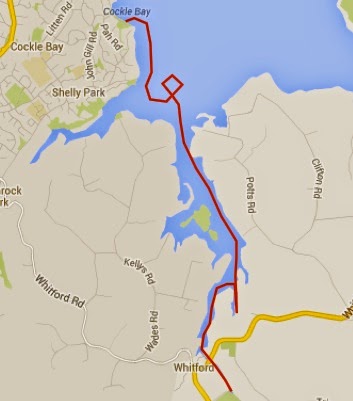
Our Route there and back again:
Here’s the map we made.
You won’t see any of these names on a DOC map, but they tell our story.
What we did well:
1) We sought lots of good advice while planning this trip.
2) We carried several copies of maps with us – laminated and
in clear snaplock bags. We attached
these to the tops of our kayaks so you could access them at all times)
3) Take a copy of ‘Swallows and Amazons’ with you
to read each night.
Every adventure must
have a literary component.
What we learned:
1) We can paddle for longer than we thought.
2) When putting up Ciao’s sails it is important to avoid a sudden gust of wind
that causes your boat to do a 180 degree turn on the spot. Avoid having an audience of local fishermen
watching you when you do this. Very embarrassing.


 Not having planned to walk today, my shoes were at home. I would like to add for the record here, that we do not think Crocs shoes are cool. Except for kayaking. They are great for kayaking! But not for public viewing or walking or admitting to owning at all. Well, having no shoes other than my dear Crocs meant that I had to do the walk of gravel and shame for 45 minutes each way to the car to get the keys. I will say no more. The memory is still painful.